The President of the Republic of Indonesia, Joko Widodo, admitted that Indonesia is the sixth largest global carbon emitter (Kompas, 2015). WRI’s 2012 data shows that 1.98 billion tons CO2 is emitted annually. The forestry sector is the greatest contributor of carbon emitted from deforestation and forest degradation (UNDP, 2007 ). In 2011, the Government of Indonesia issued Presidential Regulation No. 61/2011 on National Action Plan for Greenhouse Gas (GHG) Emission Reduction 2010-2020. Indonesia also ratified the Paris Agreement through Law No. 16 of 2016 on Ratification of Paris Agreement to the United Nations Framework Convention on Climate Change. Indonesia is committed to reducing emissions by 29% on its own efforts and as much as 41% with foreign aid by 2030 under business-as-usual scenario, through sectors including forestry and agriculture.
But Indonesia would never reach its emission reduction target that it has set on its own without addressing deforestation and forest degradation. Facts show that Indonesia’s forestry history is one of deforestation, from back in the day until this very day. In the 1970s deforestation rates reached 300 thousand hectares/year (FAO/WB, 1990), and in the 1990s these numbers rose to 1 million hectares/year Sunderlin & Resosudarmo, 1997). FWI and GFW’s 2001 analysis shows that deforestation rates continued to rise, reaching 2 million hectares/year in 1996-2000. In 2001-2010, deforestation rates reached 1.5 million hectares/year and 1.1 million hectares/year in 2009- 2013 FWI, 2011 & 2014).
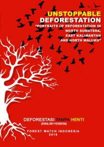
FWI’s most recent study shows that, though the study was done only in three provinces, deforestation rates are still high for 2013-2016 with reached 240 thousand hectares/year, which was an increase from the 2009-2013 figure of 146 thousand hectares/year (FWI, 2014). When combined, North Sumatera, East Kalimantan and North Maluku have lost 718 thousand hectares natural forest in the last three years. Other analysis has found that 72% of the deforestation occurring in these three provinces is located in areas under management permits. Activities in forest concessions (Hak Pengusahaan Hutan – HPH), industrial plantation forest (Hutan Tanaman Industri – HTI), oil palm plantations, and mining concessions are direct causes of deforestation.
Deforestation rates in North Maluku and East Kalimantan provinces have significantly increased compared to rates in North Sumatera. In North Maluku, deforestation rates doubled that of the previous period from 25 thousand hectares/year to 52 thousand hectares/year. Similarly in East Kalimantan, deforestation rates nearly doubled from the previous period from 84 thousand hectares/year in 2013 to 157 thousand hectares/year in 2016.
Findings from North Maluku Province show the poor performance of HPH (now Natural Forest Timber Production License or Izin Usaha Pemanfaatan Hasil Hutan Kayu dalam Hutan Alam/IUPHHK-HA) concessions is one of the direct causes behind forest loss. Mining and oil palm plantation concessions are also major contributors to deforestation in this province. Meanwhile in North Sumatera, the primary factors driving deforestation are HTI and oil palm plantation expansion into HPH concessions. Rampant deforestation by HTI is caused by land clearing during land preparations for plantation forests. In East Kalimantan, the conversion of natural forest into oil palm plantations is indicated to be the primary driver of deforestation, along with mining concession expansion.
These deforestation facts demand for the Government of Indonesia side with communities living in and around forests. This includes realizing the Government’s commitment in reducing emissions, protecting the environment, preventing disasters, and conserving natural resources. Facts show that 50% of all land in North Sumatera, East Kalimantan and North Maluku is controlled by concession holders. Only 4% of the land is controlled and managed by communities through social forestry or customary forests. In addition, facts show that forest degradation and deforestation in these provinces have led to natural disasters: flood, landslides, droughts, and loss of wildlife habitats.
As a final reflection, there is a current tendency in which natural forest loss is progressing toward eastern Indonesia. The reason being is none other than because natural forests in Sumatera and Kalimantan Islands have already disappeared. Natural forests in eastern Indonesia are mostly located along coastlines and small islands. Loss of these forests in small islands can create dire impacts as opposed to forest loss in larger islands. Islands sinking, sea water intrusion, and loss of livelihoods among coastal and small island communities’ in eastern Indonesia are real and imminent threats.