KARST SAGEA: The Magnificent Bokimoruru Cave and Its Threat

Halmahera Island has many natural wonders – volcanoes, small islands, and a rainforest ecosystem with endemic biodiversity. One of these wonders is the Sagea Karst Ecosystem which stretches over 5,174 hectares to the east of Weda Bay, Central Halmahera Regency, Eastern Indonesia. This ecosystem has unique features that have not yet been revealed.

Karst
karst sagea
Distribution of the Sagea Karst Landform morphology, Halmahera Islands

The hills to the north of Sagea Village were formed from limestone during the Paleocene – Eocene period, around 65 to 38 million years ago. This hill is exposed almost 1000 meters above sea level with a tropical climate, so the karstification process is developing well. This is characterized by the development of karst landscape morphology on the surface (exo karst) and below the surface (endo karst).

In the hills of the Sagea Karst Ecosystem, many sinkholes (water drainage holes – or it called collapse dolines) are found. These sinkholes are visible to the naked eye from satellite imagery and have a fairly large diameter of around 100 350 meters. Its location in the middle of the forest makes it difficult to access these holes. Until now, not many have studied its depth and revealed the secret that lies at the bottom of the sinkhole.

The Sagea karst has the potential to store enormous water resources. There are at least several allogenic rivers in the north – which stream southward and enter the cave system in the Sagea karst, and have a very wide water catchment area.

Giant caves

Sagea Karst has caves with long passages and large, spacious chambers, and it also has a network of underground rivers. The organisms in this cave have not been explored much or revealed scientifically, so it has the potential to have a high level of endemism.

Batu Lubang Bokimoruru Cave is one of the underground river cave systems found in the Sagea karst ecosystem. Explorations carried out by APS France between 1986 and 1990 succeeded in mapping the Bokimoruru cave which is 8,685 meters long. Until now, it is recognized as the longest cave system on Halmahera Island.

The passages and chambers in the Bokimoruru cave are very large, Bokimoruru cave has a very large size, which may exceed the size of an airplane hangar. The roof and floor of the cave are decorated with various giant white ornaments. Water drops from each ornament indicate that the process of forming the ornament is still ongoing.

THE LARGEST UNDERGROUND RIVER IN INDONESIA?
Bokimoruru cave
Underground river stream in Batu Lubang Bokimoruru cave, Sagea Karst, Halmahera Islands - ©Azizfardhani, 2023

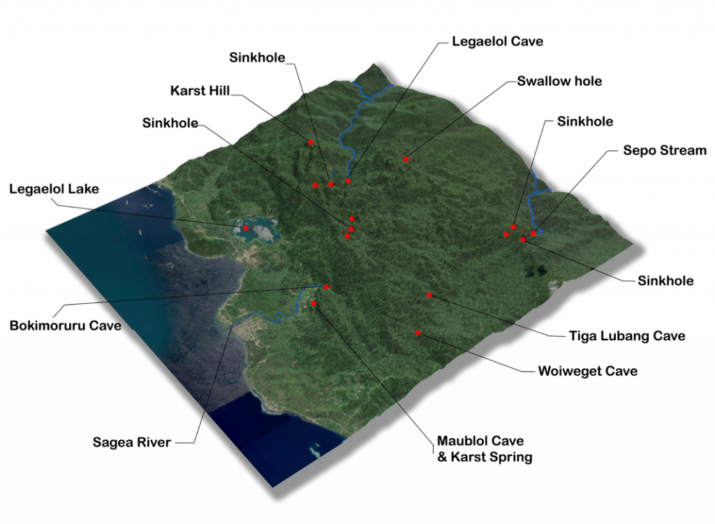
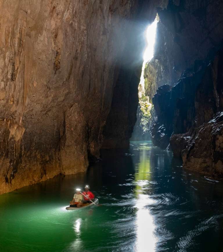
The Sagea River is part of the underground river system of the Batu Lubang Bokimoruru Cave, with the water resurging through the entrance of the cave. The water is crystal clear and it flows throughout the year with a discharge of around 7.3 m³/second (APS, 1988). This is sufficient to meet the basic water needs of around 1 million people per day, equivalent to the water needs of the population of North Maluku Province.

Although there have been no studies that directly reveal the source of the underground river stream of Bokimoruru Cave, it is believed that most of the water discharges from the Yonelo and Sepo Rivers in the north. These two allogeneic rivers flow south-southeast and enter the cave system in the Sagea Karst area, then reappear six kilometers away in Bokimoruru Cave.

On the other hand, the Sagea River has important value for the Sagea people. Since ancient times, the Sagea River water has been used by local communities as the main source for drinking, bathing and washing. The Sagea River and Bokimoruru Cave became the route and location of Arwahan, a community ritual carried out by the locals every year to honor their ancestors.

More details can be downloaded at the link below:
Factsheet The Magnificent Bokimoruru Cave and Its Threat
Published: August 16, 2024
Thank you for your vote!
Post rating: 0 from 5 (according 0 votes)

Add Comment

Get the latest news via email

Good Forest Governance Needs Good Forest Information.


Using and sharing site content | RSS / Web Feeds

Photos and graphics © FWI or used with permission. Text available under a Creative Commons licence.

© Copyright 2020 FWI.
All Rights Reserved.

to top